RMB24
New Member
-
Joined
-
Last visited
-
Never caught one, but from videos i've seen they look to be quite the handful lol
-
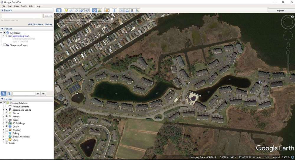
There are actually 2 ponds at the place we will be staying. There is a nice dock along the area by the pool. Most of the shore line is tough to get near the waters edge cause of high grass or cat tail like vegetation.. they are not cat tails but grow the same way.. just know what they actually are. Then there is also the Bay which i tried to fish last year but didnt get any bites. I think there may be strippers in there.. the name of the bay is Little Assawoman Bay.
-
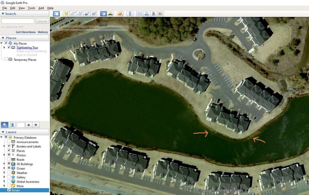
I scrolled through several dates to find a good image to see better details, so thats how I ended up with March. I know its pretty dingy that resembles pea soup this time of year.
-
To look at images from history you need to go to , View then go down to Historical. Then just move the slider to what time of year you want to view.

-
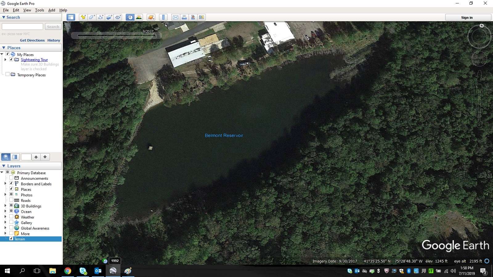
Good, my gut feeling was right ?. I will be down there on Saturday untill the following Saturday. In Google earth I measured from where the breakline starts off shore to the bank and says its approximately 20ft. Gonna have to keep a mental note of that for that area. This is my home body of water in Northeast PA I go to 90% of the time. There is a beaver d**n just to the right of the beach area about 30'. I get hung up a lot on this side ( thanks beavers ). I throw general bass jigs with a trailer, spinner bait's, recently bought a buzz bait but for some reason i cant keep it on the surface with out really cranking the reel or else it stays about a foot below the surface. I know its deep down here i think 20 ft in the general area of where what I think is a pump house and is usually pretty poor visibility depth about 1-1/2 feet. On the right side is where the beavers built a dam, but its pretty shallow and is a lot clearer water. A spring comes down off the mountain on that side too, which I would fish around but its through thick brush and high weeds. The only way to get there is by boat which there are 2 there to use but kids in the neighborhood come over to swim and use them and jump out and swim back to shore. Its tough fishing here, been fishing it for about 3 years now and still having trouble producing anything from it.

-
Ok with that being said , that is considered structure correct ?
-
This was taken in March 2007. The place we stay is called Bayvilleshores in Fenwick Island,DE. When I was down there last summer I want to say maybe 5 seconds with a 1/8th oz Texas rig worm To me I think it looks like depth change.
-
Hi all. I will be leaving for vacation next week to Delaware. The place we stay at has 2 man made ponds that I have fished before. I use google earth to scope out new places normally but recently I have been trying to study a body of water before i go to a new place or somewhere I haven't been to in a while. I took a screenshot of one of the two. The Orange arrows I placed is the question i have. The area where light green and dark green line meet, is that a weed line or is that depth change? I'm a bank fisherman with no fancy electronics.. so finding weed lines or break lines under the surface without the depth finders can be difficult.