
Fourmilekayak
New Member
-
Joined
-
Last visited
Everything posted by Fourmilekayak
-
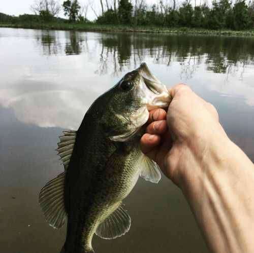
I would start out with a buzzbait as early as you can and hit the grass beds on your way out from the launch. Once the sun starts to really hit, I'd give a super fluke nose-rigged or weightless on an EWG hook to mimic baitfish. The weightless on an EWG is great to throw into cover in shallower water like that. I'm used to fishing the Potomac in my kayak and there's a sizeable area I like that runs around those depth. Definitely a spinnerbait in the deepest areas depending on what structure you find. When it's that shallow, I usually don't use crankbaits because I get them snagged. That could definitely just be my lack of skill with them, but the above options seem to work well in enticing a bite or attracting attention to an area when I hit a new place like that. Hope it helps! I like the bottom section of the middle. It looks like it drops off quicker than the other areas there. With what I see to be like 9 feet for the max depths, they'll definitely come up from deeper to hit top water lures when its early and lures ran a few feet down like a super fluke.

-
I've been hitting the Four Mile Run section where it opens into the channel on both sides of the airport pier (south side). The FMR side has a nice channel running up the right side before the bridges (about a 10-15 foot wide section ranging from 9-13ft, but the landscaping crews for the airport decimated all of the grass and hydrilla cover last week along the rocks. I've covered that area early morning around 5am to about 10am and there's almost zero action. Swimbaits, buzzbaits (early), sticks and Senkos, etc. I don't really see anyone pulling in much up from there into FMR whether it's from the shore or boat/kayak. As far as the other side of the airport pier, it seems to sit around 5-8 feet for the majority of the flat and then drops off into the channel quickly. My fish finder read around 24 feet about 20 feet off the flat into the main breakline and I think maybe all of the water/sewer line construction they did in FMR pushed a a lot of the bass out there to the rocks around the airport and that dropoff. When I've been biking past Roaches Run lately, it seems like it would be just perfect for some bass after this rain has mixed things up a bit. I can see tons of cover in different areas there and was wondering how people were fishing it (bank, boat, kayak, etc). Also, I found the depth charts from a while back for that are online (https://www.charts.noaa.gov/BookletChart/12289_BookletChart.pdf). Do these seem accurate (somewhat)? I know some of the areas where I described above have a changed a little, but it matches up better than I thought.
