Joseph Gabriel
New Member
-
Joined
-
Last visited
-
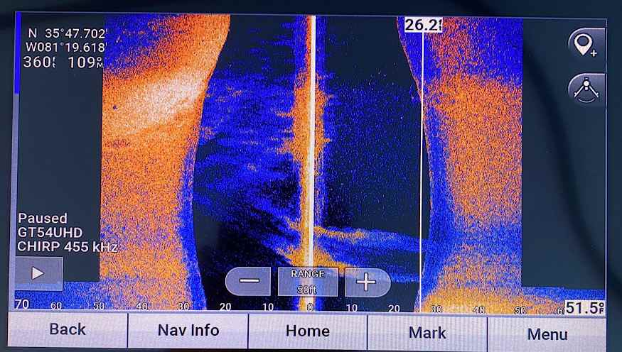
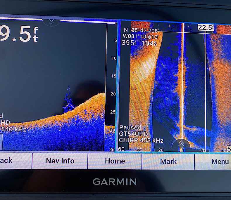
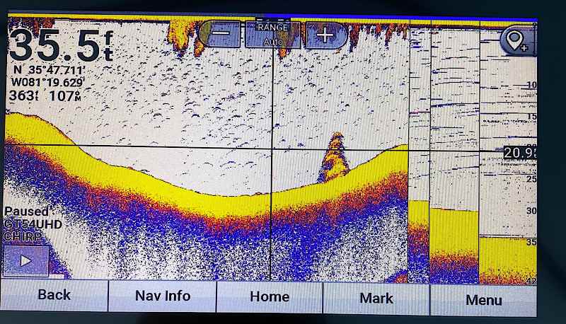
I just bought a new Garmin 93sv, and I really like it, but I have some questions on the images that I’m seeing. I know this kind of question probably gets asked all the time, but I’m hoping you can offer some additional insight above what I’ve been able to find on my own. attached are some screenshots that I took of the sonar for a brush pile that is in about 20 to 25 feet of water. First of all, for the Side imaging view, why does it look so blurry? It looks a lot more like bait, then it does a brush pile. Is this normal, or is this something I’m doing wrong on my end? honestly, even the down imaging that you can see in another picture, it looks very pixelated, almost like it’s zoomed in really far. Does that make sense? The 2D image looks very nice, and what I would expect to see. Any thoughts or advice please?