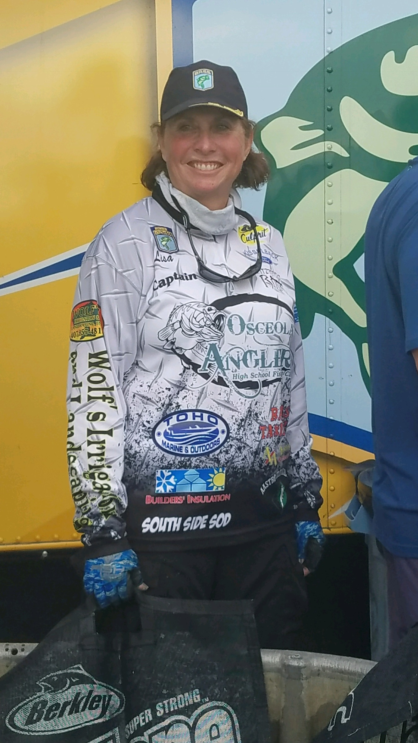
Fishing Cowgirl
Members
-
Joined
-
Last visited
-
Ohhh for sure. Good luck and many times two different styles of fishing works good in a team tournament. If she wants to throw something different because it’s pretty, let her. Some of our go to baits are ones I said” ohhhh pretty “ over. My husband is my best fishing partner and I’m not sure which of us have more gear.
-
You can check if there are teen angler or high school fishing organizations in the area. I’m involved with one in my area and it does take a ton of patience. But the reward is in teaching them sportsmanship, boating and fishing etiquette, fish care, and participation in fish studies, building fish attractors for the fish and game agency’s. Teaching different techniques then watching them start figuring it out themselves. Or seeing them try new things that you wouldn’t have thought would work but end up winning the tournament. Our club was invited to ICAST tomorrow for Youth Angler Development day. Looking forward to it.
-
Sending a message
-
-
Good reading. This is another reason we teach our high school anglers lake etiquette, ramp etiquette, sportsmanship, always ask permission to go around and respect it if they say they are fishing that line and would say no. Even if they say sure, go around, we have them refrain from making any casts until they are well past by a good distance. Slow down when passing others and boating safety for all.
-
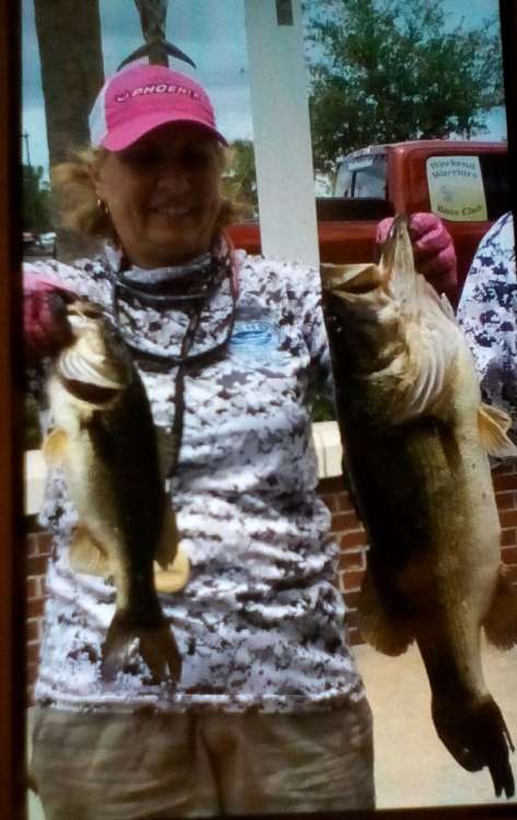
Or at a major tournament with 300 plus boats, all of us who are picking up others in the basin lined up for the ramp. It’s a one way in and out parking lot ramp area. Then two get their boats loaded proceed part way around the lot then stop to put away their gear. That left two trucks with boats on trailers still stuck half way up the ramp and a line of us still waiting. Really??? I politely ask them if they could please move so we can load up our people too. Yeah, even my husband saw me get out of the truck while in the basin and said... “ oh, she getting ready to chew on someone”?. The other was letting dead bass get weighed for big bass prize money. I lost by .02 ounces to two dead bass and $2,000.00. 1st place was the $2,000 and second big bass was $500.00. Mine was 8.29 pounds and I kept her alive all day during a hot June tournament, I came in 3rd big bass. $0.00. It wasn’t specific in the rules but oh well. A lot of guys congratulated me on catching her and keeping her alive, they thought I should have won it, but the respect I got also was worth a lot to me.
-
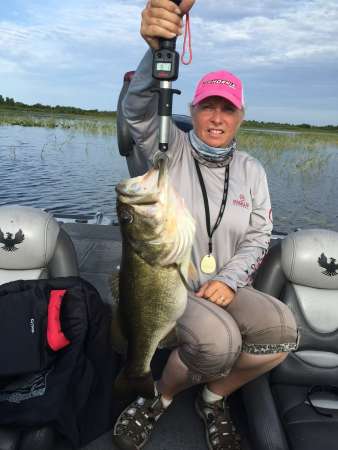
Won big bass at our Weekend Warrior bass club tournament yesterday on West Lake Tohopekaliga. 7.34 pounds. It was caught on a swim jig and a space monkey trailer.
-
That is a favorite method of mine and my husband. Fantastic for Florida even in the murkiest of water. One thing I noticed was fishing the open was the boaters were fishing very fast with the trolling motors wide open (it seemed that way when I'm having to feed out line to get my bait deeper in the water no matter how far I cast). Mostly Stick baits and Flukes. Cast it, pop it a couple times, let it fall and sit. Twitch it after 20-30 seconds then let it sit. I also used Megastrike crawfish formula for scent, if it's really nasty or dark waters. I always had my finger under the line and you can usually feel the little "tic" of the line or it just feels different when you pick it up and they are doing the Ninja bites. When my day 1 boater watched me put two in the boat dead sticking, and he had none, it clicked with him. Too late for day 1, but he thanked me the next day in the weigh in line saying he caught fish doing what I showed him. He said it was like a light bulb clicked on for that type of Florida fishing. I gave him a few more tips but dead sticking is my favorite style especially in the Florida 99 degree heat we get. My biggest bass was 8.29 pounds dead sticking.
-
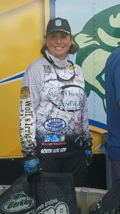
I chose Fishing Cowgirl because I would get home from school and get on my pony with fishing pole in hand. I would ride him up and down Shingle Creek (Kissimmee Chain) and fish.
-
Open water fishing and lack of electronic knowledge is my weakness. Fishing Florida shallow is my comfort zone, mostly soft plastics like a fluke or stick bait. Love throwing my swim jigs with a space monkey or rage menace trailer. Florida shallow is 2'-6'. Most lakes are very shallow at maybe 10' at very deepest holes. We tend to turn off the sonar once we hit our spot. I fish slow.. like Forest Gump talking slow. I drew some northern guys for the Southern Open here and it really made me realize I need to learn hard jerk baits, football and heavier jigs (Seibert Outdoors) like what I received for the Fishmas exchange, and what to look for the open water structures. One was kind enough to show me graphs and what to look for (Thank you Steve Priest) . So, that's what I have to work on this year.
-
It was a great time. My goal this year is to work on my open water technique. Thank you to everyone who gave me advice on being a co-Angler. I gave both Pro’s $50 to help with gas and oil. We did hit nearly every lake in the chain and they both gave me plenty of areas to cast to. It was a good way to challenge myself and the areas to work in. Sone anglers were late to check in on day two due to a lock gate malfunction. The gates opening to Toho ( higher water level) opened too wide and such a huge amount of water rushed in before the lock keeper could correct it. I was talking to a Co-Angler that was there and he said boats got slammed around, under each other, against the walls and one was even spun around and had to leave the lock in reverse. No one was hurt that I know of, thank the lord. Sometimes I wish they could remove that lock and let the chain go to natural water levels.
-
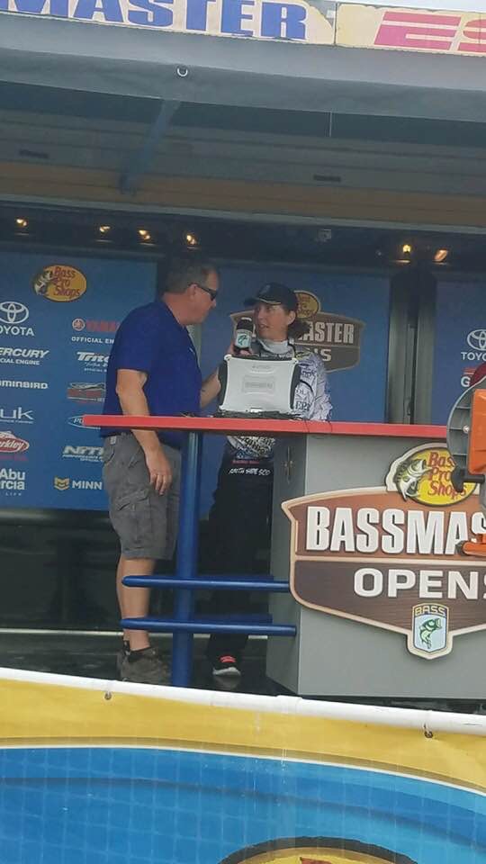
What a great time. I weighed in bass both days. Didn’t do as well as I hoped but everyone goes in there to win. My husband managed to finish in the top 40 and drew a check. Very proud of him. Practise days were with Trait Zaldain. I showed her what to look for in vegetation, depth, and we were using bigger baits. She was able to apply that to her confidence baits and apply that to her own pattern. Boat problems was something out of her control but she has a game plan for Florida in the future. Met Chris and Nebo too. Nice couple. She gave me one of her pink rods and it has a decent backbone to it. I actually used it to catch my first bass. It made a nice fluke rod since I had broke the eyes of my regular rod. Very nice rod. I was paired with Steve Priest from Ohio day one. He had found some open water fish that unfortunately didn’t want to play that day. Open water is my weak area and he showed me some techniques that can help. I really do need to work on my open water fishing since I am mostly comfortable in the shallow water. His bed fish he found had been found by others. We moved in shallow about the last hour and a half and I put two in the boat for 4 pounds. One was an “ I’ll worry about getting it in the boat if I get bit “ cast. It was 3 lbs. He didn’t have any bass and it wasn’t from lack of trying I will say that. Neither of us stopped to even eat a snack. I gave him the type of baits I was using. While he was showing me graphs and what to look for, I’d seen he’d been near an area on a practice day that we’d been shaking them off. I told him to hit the hard lines of cat tails and work slow. He weighed in a limit the 2nd day and thanked me for the Florida tips. He even texted me later to thank me for showing him more about Florida fishing than anyone else. Wow, that is such a great compliment! Day 2, I was with Brandon Johnson in the Lucas Oil wrapped boat. We hit a big grassy first and in three casts I had a bass in the boat. Then off to Lake Kissimmee. We hit another area I was familiar with and hooked another in the pads then it got hug up. Just as I was reaching for it, it shook loose. The Trokar hooks will sure hook a fish but it will make a big hole too. I lost another that spit the jig out, so I had the bites, just didn’t execute well enough. We both weighed in just one fish. I finished 134 out of 209 co-anglers. I feel pretty good and both boaters were really great to fish with. I learned a lot. My husband fished with Scott Suggs day 2. He showed Scott an area and baits and both had limits. Scott showed Kevin how to use a shaker head and that’s what he will try out. y

-
(This is the post I was looking for: The author gave permission for it to be shared. It is his observations and experience he wanted to share. Juan Ruiz on January 8th) “In the aftemath of what has happened to our fellow fisherman Nik Kayler I've put together some advise on how to travel on Lake Okeechobee. This information is how I've run the lake for the past 15 years with little to no issues. I've encountered first hand the strength that our Lake posssess and its something that should never be taken lightly. I've learned the hard way of getting stuck out on that lake in big waves and never cross the middle of that lake if I can at all costs avoid it. This is by no means an expert write up, but it'll give you some insight from my view point on how to get from A to point B. Please add any advise or different paths that you may have used and take to make it to and from your fishing destinations safely. I debated on if I should or shouldn't write this up, but in the aftermath of what has happened to Nik, he would want everyone to help each other on the lake to prevent something like this from ever happening again. Rules for running from the North end of Okeechobee to South Bay and other areas on the lake: • Any wind from the Northwest direction regardless of strength you can run the west side of the lake right down the outside grass lines with no issues. The waves get a little bumpy in some short sections but it’s all manageable if you take your time and hug the shorelines. You only gain 5-10 extra minutes running straight down the middle of the lake and if you break down you can’t trolling motor to either shoreline and if it’s rough out there you’re going lose time anyways versus taking the “long way”. You DO NOT SAVE enough time worth all the risks you take running the middle of the lake and if you break down out in the middle of the lake you’re going to be in for a long day. Make sure to avoid the mouth of Indian Prarie and make sure to run between the field goal posts at UNcle Joe's canal. I ran a Ranger 518 for almost 12 years and NEVER felt like I had to go ACROSS THE LAKE cause of time. Even when its glass flat I hate going across the Big O cause of all the things that can happen out of your control. Every new lake I go to the most important information I try to gather is where and how I can safely run to places on the lake I want to check out. • If we have a straight North wind depending on the strength (anything over 10 knots) it’s best to run the west shoreline down to & take 7 mile ditch and run the rim canal down to Clewiston. If 7 mile canal is blocked, which happens from time to time you can take Sportsman Channel to the rim canal and head south that way. If the wind isn’t too bad you can stay on the main lake and run straight down Observation Shoal to Clewiston and down to your spot on the south end. It takes roughly 28-33 minutes from Dyess Ditch to Clewiston taking 7 Mile canal and add another 10 minutes from Dyess Ditch through Sportsman Canal to Clewiston. This is based on traveling at 70 mph. From the Hayfields to the Clewiston no wake zone it takes 8 minutes if you leave the hayfields and run the lake back. If you have to adjust your trip back to Clewiston from the Hayfields add a few minutes to that. • Any wind from the SW direction will make the north end of the lake rough especially out on King’s Bar. There is absolutely no reason to run out and around King’s Bar if you’re heading south, take the pass underneath. We tend to get the majority of the SW winds in the summer time so plan accordingly to encounter rough water on the north end from a SW wind until you get to Horse Island, after Horse Island its smooth sailing. A SW wind and a NW wind above 10-15 KNOTS are DANGEROUS to travel to the east sides of the lake and fish, the SW waves will bring big rollers up into Grassy and Eagle Bay and make J&S impossible to fish plus it’ll be dirty. My rule of thumb I’ve always followed is if there is any West in the wind over 10 Knots I’m not fishing or driving on the east side of the lake. If you’re fishing out of Clewiston and want to run to J&S across the middle of the lake and it’s not an East/SE wind and its over 10 knots it’s going to be rough for half the trip so prepare yourself. I’ve run to J&S from Clewiston going all the way around the lake from both directions and it takes hour and 10 minutes to hour and half depending on how hard the wind is blowing so plan accordingly or fish a different area of the lake. • Any wind from the SE direction that’s over 10 knots will make the trip from the north end to the south end rough in the middle so you should consider running the east side of the lake down or take the long way down to the south end or vice versus. A SE wind makes running up the shoal to north shore or the north end very bumpy, but it’s manageable if you take your time. Again if its blowing 15-20 Knots out of the SE and you want to go to northshore your best bet is to take the rim canal to 7 mile canal and head up north. • If you want to run to the south end of the lake from the North end of the lake or vice versus and you get an East or Southeast wind over 10 Knots you should consider running the EAST SIDE OF THE LAKE to the south or north end. I run out of the river and I aim for the tower at J&S and once I get about 1-2 miles off the grasslines at J&S I point my boat towards the WATER TOWER on the southern bank of the dike which will be north of Pahokee and Sand Cut and clear of the reef, you should end up around Canal Point. Make sure you stay about 1-2 miles off the lake dike especially around Port Mayaca. If the wind is strong out of the East/SE I jump into the channel at Port Mayaca and follow that around the dike until I get to Pelican. There’s a channel marker I think its number 24 that you can jump into the channel at Canal Point and follow the channel markers to Pelican Bay or Kramer. The dike actually blocks the wind a ton from the East or SE direction, use the dike as a barrier to help you travel. Same idea on a West wind and the west side of the lake. • Okeechobee water levels can’t be ignored and need to be understood so you know where you can run and what hazardous areas to avoid. Remember the central part of the lake around Clewiston and southern ends of Okeechobee are a maze of reefs and rocks in many, many places. When the water level is low and its rough out you have to be mindful that you can bottom out the lower unit as you come down off a wave to choose your routes wisely. I'll write up something that explains hwo to run the lake at lower water levels. • When the lake gets below 14 feet you really have to start paying attention to what route you plan on taking, don’t be stupid and cocky, ask someone like myself what the preferred path would be to avoid any issues, I would never not help someone with directions and that goes for a ton of guys who know every inch of this lake that would be willing to help. • Please stop relying on wind forecasts that are provided for estimated winds on land and not on water. The only source of wind forecast that I use is the Marine Forecast provided by NOAA and it’s called a Marine Forecast for a reason. It’s provided in Knots format so I gauge by the forecast of 10-15 knots to me means 15-20 mph winds and ROUGH in many places on the lake. The link to that marine forecast is above, scroll to the bottom and Lake Okeechobee has its own forecast, use it, save the link to your phone. • Remember the most important thing about tournament fishing is living to fish another one and getting back safe. If you’re not sure about a travel path please, please message me and I will help you with some advice on which path to take. Now that the lake's grassbeds have been thinned out we can't rely on running the back trails from one end to the other end like we have in the past so stay safe everyone and see you all on the water. Sorry for any typos it's diffcult typing this much on a phone. Please add and share. Disclaimer: This is not intended to be used as a navigation guide it's just some advise, take your safety on the water into your own hands and be prepared. #PRAYFORNIK #FINDNIK http://forecast.weather.gov/product.php?site=MLB&product=CWF&issuedby=MLB I just thought this may have some useful information for others Fishing this Lake. If it isn’t allowed, please delete it
-
I was trying to find a very informative post on the Facebook page of the boaters looking for Nik. It suggested trails, and cuts to take on that lake when the winds are from certain directions, and what wind speed. Learn the rim ditch cuts, canals, and trails to stay off the main lake. It may take you 10 minutes or more extra but you'll get there safely and back. If I find it, I'll post it here. My Brother in Law is a contract Tugboat Captain. He pushes barges from the Gulf to Atlantic through Okeechobee and back. He has said that lake is more dangerous, with bigger waves, than the Gulf or Atlantic waters, and he is in a 50' Tugboat. The waves come up faster, harder and have broken the ties to the barges before.
-
I agree. My husband and I both captain for a High School Fishing Club. None are our own kids but all the kids treat us like we are extra parents with a boat. It is gratifying to take young freshmen anglers out. We teach the boating safety, ethics, courtesy about respecting other fisherman’s space, which direction are they going-don’t cut them off, ask permission to go around, how to back up a trailer, ramp etiquette, how to load the boat, run the trolling motor and in case of emergency to even get back to the ramp. Then we get into hook sets, baits, reading the maps, bait choice. We bring in speakers from Fish and Game, Elite fisherman like Bobby Lane, other pros, business men. They compete for scholarships and we were able to take a team to the World Finals High School Fishing championship. We’ve done live well tests with the FWC. It is rewarding for not only us but for the kids too.